Delivering practical and cost effective aerial intelligence through leading edge Remotely Piloted Aircraft Systems (RPAS) services.
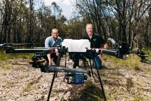
Ninox Robotics provides tailored services for a variety of industries.
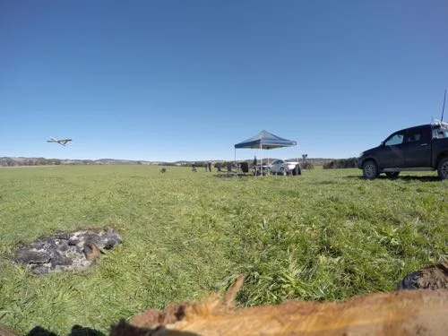
Our services are well suited for operations over extensive areas, or where an area must be covered fast and frequently.
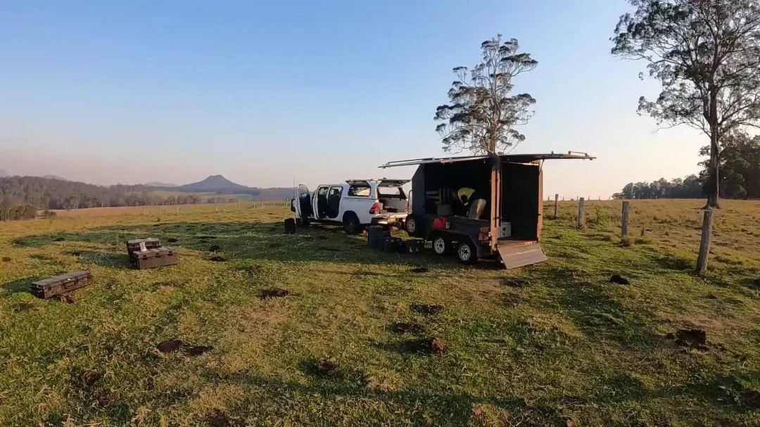
A team can be deployed to almost any location in Australia.
Select an industry below to see what we can do for you.
If your area of interest or industry is not listed here but you believe our services could benefit you, please contact us.
Our system is flexible, and as such can often meet unique requirements.
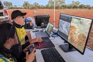
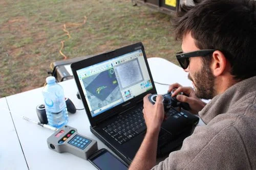
Data Delivery
Data Delivery
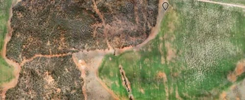
Ninox Robotics can deliver a variety of aerial intelligence products. We work with our clients to best understand their objectives and detailed requirements, enabling us to deliver quality outcomes in a seamless, efficient and timely manner.
Our data offerings include:
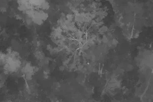
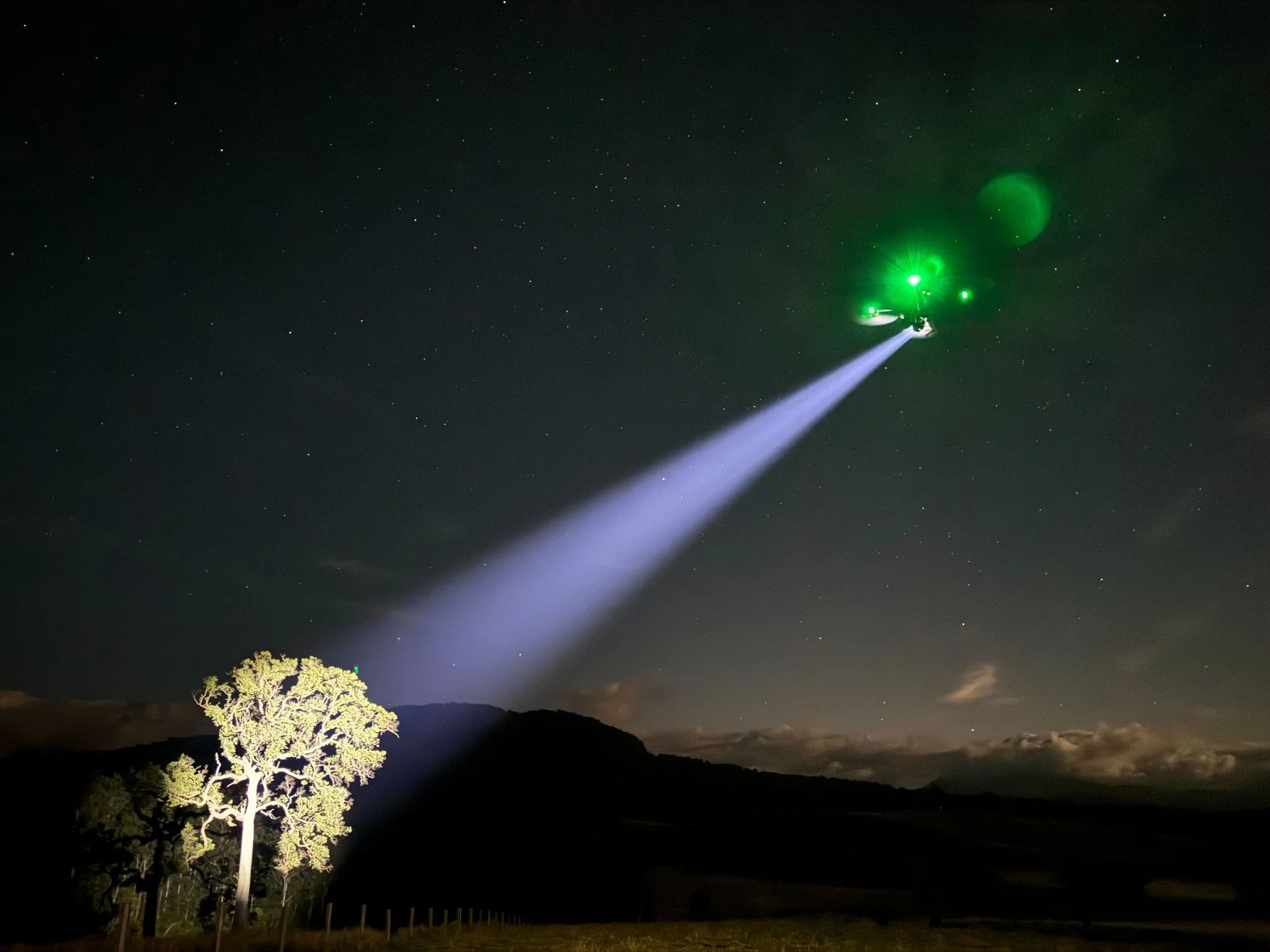
- dual thermal/optical video streaming, with geo-referencing and other telemetry data
- survey, mapping and inspection data, orthorectified mosaics (up to 1cm/pixel), elevation models, point clouds, etc.
- digital delivery, We focus on maximising modern technology and systems. This means we deliver data digitally first.
To learn more about exactly what kind of data you can collect, select an Industry Service.
Distribution maps are formed when detecting objects such animals. Each individual object can be selected to reveal relevant information.
Maps can be interactive and 3D, with coloured informational overlays relevant to the application at hand.
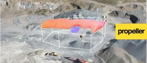
Data can be viewed in our optimised viewing systems, but can also be provided in a variety of standard formats.
We provide both online and offline delivery as required.
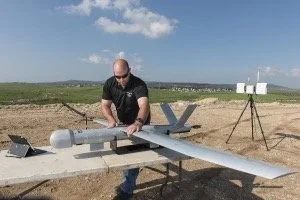
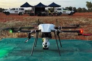
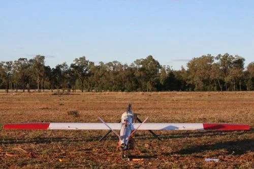
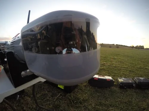
UnCrewed Aerial System
Ninox Robotics uses highly capable uncrewed aerial systems so that you get more out of our services.
With a flight time of around 4 hours, a lot of ground can be covered in a single flight - exceeding 100 square kilometers for some applications.
The system can operate at ranges up to and exceeding 50 kilometres from the ground control station, so you can reach remote and inaccessible areas.
Our team quickly deploys to location, with everything they need for a single flight to a month long operation. The system can be set up and operating in under 30 minutes.
After a safe landing using a parachute and airbag, the system's battery can be switched with a fully charged one. Utilising the catapult launcher, the system can be up and running again in minutes.
Each camera system provides imagery in incredible quality - whether that be in infrared or optical, photogrammetric or streamed live. Cameras can be easily swapped as required for different applications.
Extreme weather can prevent effective operation of the system, but with a top air speed of 120 kilometers per hour the system can safely handle sudden undesirable weather and return to land.
We have put in place extensive precautions to prevent any unwanted incidents from occurring, and as such have met all relevant safety regulations.
An autopilot augments the system, and our team will work with you to plan the most effective flight paths. We deliver your data with an accurate record of what happened when and where.
The system's flexibility often allows it to be utilised in several different ways for each client. It also means we can often cater to unusual applications not explicitly described on this website.
COMPANY INFORMATION
COMPANY INFORMATION
If you are interested in utilising our services, or have any questions,
contact us at team@ninox-robotics.com, call 1300 377 977, or request a quote below.
Ninox Robotics is a leading provider of managed RPAS services to strategic industries and government. We provide practical and cost effective aerial intelligence to our clients. We are proudly Australian owned and operated, and our RPAS teams can be deployed to almost any location in Australia.
Ninox Robotics is a member of AAUS and actively pushes to develop the industry.
Ninox Robotics holds Operators Certificate (OC) CASA.UOC.0367 and is one of the few commercial RPAS operators in Australia permitted to fly:
extended operations beyond visual line of sight (BVLOS)
above the usual 400ft RPAS flight ceiling
at night
Operating since July 2016, Ninox Robotics services a range of strategic industries including conservation, government, security, key national assets and resources.
We endeavour to exceed expectations by providing services that revolutionise the collection and utilisation of data.
Relevant government entities can enlist our services through Local Buy without the requirement of a full tender process.
Below is a list of some clients benefiting from our services.
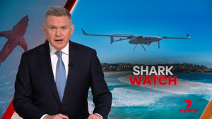
“HQPlantations commissioned Ninox Robotics’ long range drone service for a trial over a section of our forestry plantations. The purpose was to evaluate methods other than traditional fixed wing aircraft for the collection of aerial data and derived products to assist us in improving the nature of our operations.
Ninox Robotics were tasked with the delivery of a number of high accuracy aerial data products. The overall process was cost-effective, timely and very well managed from start to finish, with key stages being: requirements gathering, CASA BVLOS airspace approval, flight planning & data collection, processing, quality assurance checks and delivery.
We valued Ninox Robotics’ technology and professionalism, as well as their commitment to customer engagement and service delivery. All deliverables were of a high standard and the resultant data was utilised to assist our operations teams. Looking to the future, we see this service offering as a valuable new tool that can complement and potentially replace existing legacy technologies.
We recommend their services to those in the forestry industry who wish to utilise new technologies to assist and improve their operations.”
— Lee Stamm, Resource Planning Manager, HQPlantations
“In late 2020 Balonne Shire Council engaged Ninox Robotics to perform a Proof-of-Concept flight over 2 river systems in the Balonne Shire looking to identify specific pest weeds - tree pear cactus, prickly pear cactus and parthenium.
Ninox Robotics performed numerous flights over these river systems in several different locations, capturing data through the drone’s camera. Ninox Robotics then entered and evaluated that data and successfully identified the locations of tree pear cactus and prickly pear cactus. It was found that the parthenium was quite hard to identify and locate due to the dryer season, sparseness of the infestations and the size of the plants. Ninox Robotics supplied Balonne Shire Council with a full report of their methodology, pest weed locations, results and any improvements that could be made to make the process more efficient or practical.
Ninox Robotics were great to work with and were very open and honest on how they could deliver results and where it could be improved. It was great to see how artificial intelligence and drones can be brought together to capture data that can not only identify individual weeds but also give location, infestation extent and size which will in turn reduce cost and time spent to stakeholders.”
— Lachlan Grundon, Rural Lands / Environmental Officer, Balonne Shire Council
news
news
Early warning: human detectors, drones and the race to control Australia’s extreme bushfires
'Coalition of the willing': Extreme weather drives startups to commercialise fire tracking tech
or visit our newsletter archive.